


On Nov 15, 2011, I did a marathon distance (42.2 km) hike/run in the Gatineau Park in Quebec. Here is a description of the route:
From Chelsea parking lot P8, up Gatineau Parkway for abt 1.5 km, right onto Trail #1 (Ridge Road), pass Keogan cabin, cross Fortune Parkway, continue on Trail #1, pass Shilly Shally Shack, pass Huron cabin, turn right at Champlain Lookout intersection (optional side-trip by turning left to the Lookout), continue on Trail #1 going west, pass Trail #9/Western cabin (optional side-trip to Western), continue till McKinstry cabin, then finally the Lusksville Firetower; Return. The route distance as described without the side-trips is abt 42.2 km. But if you take the side trips to Champlain Lookout & Western Cabin, the total distance will be longer than a marathon.
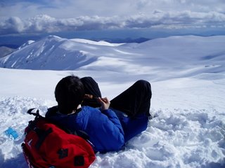
Below are the satellite route map + photos I took along the way.


+++++++++++++++++++++++
Original text sent by BlackBerry:
Earlier this week, I took advantage of the warmer-than-usual weather and did a 42.2 km run/walk in the Gatineau Park.
I started from the Chelsea parking lot P8, walked up the Gatineau Parkway, and turned right onto Trail #1. From then on, I ran/walked my way up to Champlain Lookout and continued on to the Lusksville Firetower. The mostly uphill route from Meech Lake P8 to Lusksville is abt 21.1 km one-way. The return trip is close to 42.2 km.
I will post some of the photos l took along the way when I have a chance.
Sent from BlackBerry
(Update 20180604: The total distance is closer to 42.2 km as opposed to the 44 km originally reported)
8 comments:
eagerly awaiting for the photoes!
prettyyyy...u always make me wanna fly abroad whenever season changes!
the fall colors are great!
SBB: Hope you enjoy both the photos and the video.
啤酒花™_J: I too enjoy the shows by Mother Nature!!
SBB: And now we are waiting for a white Xmas!
Turkey feast for the X'mas!
SBB:
今年火鳮已在 butcher shop 訂了,聖誕前夕取貨!!!
Post a Comment